Art of the Rural 2025-2026 Spillway Fellow
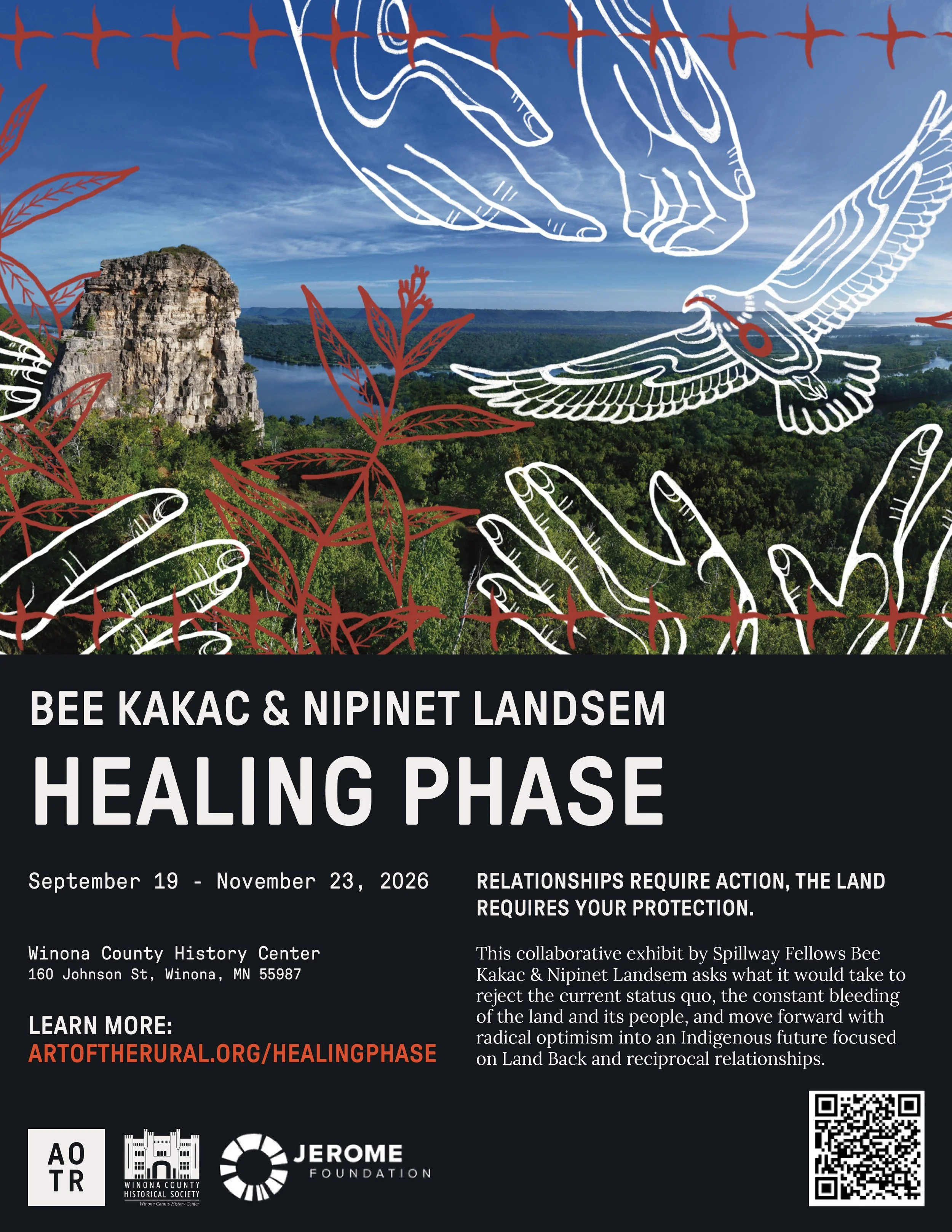
Healing Phase
Relationships require action, the land requires your protection
Mni Sota Makoce, the land now called Minnesota, is a place that carries stories of creation, migration, harm, and healing. This land is covered in scars from colonial expansion, resource extraction, and industrial development— scars that are proof of a lack of relationship to the land. These wounds have become background noise to the cadence of modern life, whether because the abuse is hidden in depopulated and rural places, or because extraction, industry, and urban expansion are seen as progress instead of colonial violence. The last five hundred years of colonization have conditioned us to accept harm as necessary. We’re used to the white noise of colonial injury. We often do not recognize the violence that is happening around us, to our relations, our kin. We need a paradigm shift.
Healing Phase is a collaborative exhibit that asks what it would take to reject the current status quo, the constant bleeding of the land and its people, and move forward with radical optimism into an Indigenous future focused on Land Back and reciprocal relationships. Through Bee Kakac’s drone photography and Nipinet Landsem’s illustrations, it asks us to reimagine our relationships with eight places across the state, sacred places, Dakhota and Ojibwe and Michif places that have been transformed by the impacts of Enbridge’s Line 3 pipeline, industrial agriculture, and the constant growth of settler colonial spaces. It asks us to build relationships with these places, to learn to see them, and to move forward with different priorities.
We cannot go back. We can’t turn back time. We can only move forward in a good way, and build relationships that heal.
Enbridge’s Line 3 Damages
Enbridge’s Line 3/93 Damaged Site Tour- 2023
This is a “site tour” of 11 locations along Enbridge’s Line 3/93 corridor in northern Minnesota. Line 3 is a tarsands pipeline that crosses over 200 bodies of water in Minnesota alone. Construction began in late 2020, the resistance against it began years prior and is ongoing today.
This footage shows a variety of Enbridge’s construction damages beginning on the west side of Minnesota, along the Red River of the north; and ending on the east side of the state 400 feet west of the Fond du Lac Reservation. Most of this footage is from summer, in 2023.
So far, MN state agencies and the media have publicly acknowledged four aquifer breaches caused by the construction of Line 3/93: the Clearbrook Terminal in Clearwater County, LaSalle Creek also in Clearwater County, Moose Lake in Aitkin County, and at Fond du Lac in Carlton County. Unfortunately, there is evidence of many more aquifer breaches which we will see in this video.
Update on Enbridge’s Line 3/93 Pipeline Damages- 2025
This is a presentation I gave on October 1st, 2025 at the Carl W. Kroening Nature Center next to the Mississippi River in Minneapolis, Minnesota. Three Waters Pipeline Resistance Team organize this event and I am super grateful to all involved. The presentation includes drone images of the damaged land along Enbridge's Lin3/93 pipeline in northern Minnesota. In 2021, Enbridge pierced multiple aquifers across 337 miles of northern Minnesota. Water continues to pour from the earth in multiple sites across the state. The Minnesota Department of Natural Resources needs to be transparent with the people about these sites.
Enbridge's Line 3 Crosses Walker Brook-
Fall 2023
This video is about Walker Brook, a wetland that was destroyed by Enbridge and its contractors during the construction of the Line 3/93 pipeline.
Enbridge’s Line 5 in Wisconsin
Water Protectors Occupy Wisconsin Department of Natural Resources Office to Protest Approval of Line 5
On January 13th, 2025, Indigenous Water Protectors and international climate justice organizers rallied at the Wisconsin DNR's headquarters in Madison to protest its recent approval of a permit to construct a 41-mile reroute of the Line 5 oil pipeline in northern Wisconsin. That go-ahead came just days after the agency was notified of an oil spill from Enbridge’s Line 6 pipeline near Cambridge in southern Wisconsin. The Bad River Band of Lake Superior Chippewa have fought Line 5 for years, pointing to the risk of a massive oil spill that threatens their traditional hunting, gathering, and fishing grounds and Lake Superior.
The group of around 50 gathered at the Capitol at 9 am. Indigenous Water Protectors and activists spoke and expressed their frustration that the DNR approved the permit for the Line 5 reroute, over the objections of the Bad River Band and the public, despite Enbridge's history of oil spills and environmental destruction, and in the face of a worsening climate crisis. The group then marched to the DNR to deliver a letter to DNR Director Greg Pils, demanding that the DNR revoke the permit and support the decommissioning and removal of Line 5. The group occupied the DNR lobby and stated their intention to stay until someone would speak with them.
Line 5 carries up to 23 million gallons of crude oil and natural gas liquids every day from Superior, WI to Sarnia, Ontario. Both Lines 5 and 6 are owned by Enbridge, a Canadian multinational oil corporation. Line 5 currently crosses 12 miles of Bad River Band territory. In 2013 the Bad River Band declined to renew Enbridge’s easement to operate on their land, and they filed a federal lawsuit in 2019 to remove the pipeline from their reservation. In late 2022, a federal district judge ruled that Enbridge was trespassing on the tribe's land, and a federal court recently ordered the section of the pipeline running through Bad River lands to be shut down by 2026.
Enbridge's Line 5 pipeline is just feet away from being exposed to the Bad River's current and must be shut down.
Check out the film (unrelated to my work)
https://badriverfilm.com/
Line 5 Crosses the Bad River
On November 11th, 2024, an oil spill was reported to the Wisconsin Department of Natural Resources. Initially, Enbridge reported a 2 gallon spill at one of their pump stations located just south of US Highway 18, about 5 miles east of Cambridge, Wisconsin.
The next day the amount spilled was revised to 126 gallons, which was revised again to almost 70,000 gallons.
News of the spill reached the public a month later, around December 12th.
On December 17th, 2024, I published the first aerial images of Enbridge’s oil spill in southern Wisconsin. These photos have been shared hundreds of times on several social media platforms and news outlets.
Read the Milwaukee Journal Sentinel article here.
Enbridge’s Line 6 Oil Spill


Between December 12th and December 15th, I read many articles about this oil spill, almost all of them featured stock photos of Enbridge’s storage tanks in Superior, Wisconsin. There were no photos of the site that I could find.
After learning the location of the oil spill from their Accident Report made with the U.S Department of Transportation Pipeline and Hazardous Materials Safety Administration, I drove four hours to the site to get drone photos.
On December 17th, I published these photos from my personal account, not knowing what impact they would have.
Since posting, these photos have been shared hundreds of times on multiple social media platforms and by several media outlets, including the Milwaukee Journal Sentinel, whose article about the spill you can read here.
